20th April 2013
Distance : 32km
Ascent : 1142m
Time : 8hours

On the evening before, I had driven up to Inverness and stayed at the soulless Fairways Travelodge. An early start and I drove to Garve where I parked the car near the railway station. The weather was overcast, with a little light rain as I waited for the train towards Kyle. Eventually it rolled into sight and I was on my way west to Strathcarron.
Alighting at Strathcarron, I was all ready to set off and was along the road before the train had disappeared along the coast. After a few hundred metres of tarmac I left the road and followed the wide River Carron as it meandered through the fields to the east of New Kelso farm. Too soon I reached the road again and nipped along to leave it at Coulags. Here was where the wilderness began.
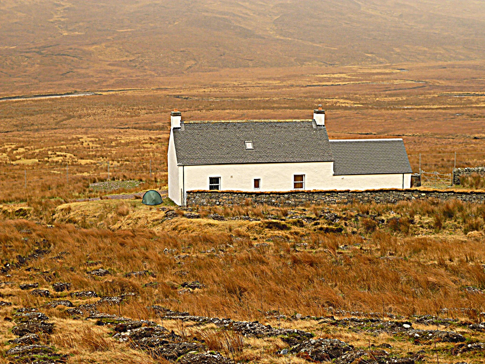
 |
| Coire Fionnaraich bothy |
I made rapid progress up the stalkers' path to the Coire Fionnaraich bothy. No-one was at home so I took the opportunity for a seat and a snack. The weather wasn't improving much, fairly breezy with moisture in the air, but not raining as such. I continued onwards past the massive mossy Clach nan Con-fionn and then round the lonely loch at the head of the glen. Two paths converge here, and I passed two females who had crossed the Bealach na Lice from the west. I went east at the junction and climbed higher to the Bealach Ban and into the mouth of Coire Grannda. I passed some impressive slabs of Torridonian sandstone whilst looking north to the same mountains. Unfortunately they were shrouded in cloud but the wind was strong enough to press me on my way. I briefly had a contact lens mishap in the wind and had to perform some fiddling to regain my sight.
 |
| The frozen Lochan Uaines below the Corbett Sgorr nan Lochan Uaine |
I contoured round the side of Sail Gharbh and then ascended towards a series of three small lochans, named Uaine, but actually white and partially frozen today. The wind was growing in strength and I ascended the Corbett of Sgorr nan Lochan Uaine with trepidation. The summit was wild, and the tiny cairn offered no shelter. I needed some food so quickly stuffed some chocolate in my mouth before descending due north out of the wind and into the complexity of this wild land. Although I was carrying a 1:50K map, even the detail of a 1:25K map is not sufficient to define this area of ground. I found myself backtracking on several occasions to negotiate wee unmarked crags and lochans and at this stage of the day found it quite frustrating.
 |
| Looking back to Sgorr nan Lochan Uaine - some very complex terrain here |
I found a grassy rake to follow across the face of a steep cliff which led to the path up to my next Corbett, Sgurr Dubh. After dumping my rucksack (and memorising its location!), I ascended the 200m up to the rocky summit. The wind was mental now, and a squall of sleet came through as I battled to reach the summit. The shattered quartzite was lethal when wet and I did well to not be blown over.
Returning to the 'sack, I was relieved to be back on some sort of footpath again, and not have to woory too much about navigation. The path led me down into the gnarled forest beside the Allt na Luib and the settlement at Coulin. It was probably around 5.30pm now and I was thinking about stopping for the night, but there weren't many obvious sites to pitch that wouldn't impact the natives. Three working dogs (lab, and two terriers) came racing up the track from the keepers house. Simultaneously barking & wagging, I kept them at walking pole's distance just in case.
 |
| The road to Kinlochewe |
I reached the tarmac of the estate road, and plodded onwards to the Glen Torridon road. I knew from past visits there'd be no suitable wild camp spots within easy reach of fresh water / away from the road. So made the decision to try Kinlochewe Hotel. After a phone call to check availability (and most importantly when they would stop serving food!), I upped the pace and reached the village in an hour.
--------------------------------------------------------------------------------------------------
21st April 2013
Distance : 20km
Ascent : 600m
Time : 6hours

The sleep of the dead. After a hearty breakfast, I left the village and followed the tarmac and then track to the Heights of Kinlochewe. The weather was warmer, with even some blue sky in patches. The Abhainn Bruachaig to my right was an impressive river emanating from the hills ahead. In my ears, I listened to a recorded 6Music radio programme from Marc Riley the week before. Some fantastic tunes.
.JPG) |
| Beinn Eighe with Abhainn Bruachaig in foreground |
.JPG) |
| Get the map out here to doublecheck! |
.JPG) |
| The quartzite slabs of Sgurr Ban in Fisherfield |
.JPG) |
| Looking to A'Chailleach in the Fannichs |
After reading everything I could find (visitors' books, old newspapers, leaflets), sawing up the damp bogwood and generally getting bored, I made some dinner (not successful with cold gas) and then decided I'd prefer to camp. I found a lovely flat grassy spot in the leeward end of the lodge gable to pitch my tent which I'd now lugged over 52km since the day before. With the shelter from the wind, I actually slept very well.
.JPG) |
| Loch a' Bhraoin lodge - not the bothy! |
--------------------------------------------------------------------------------------------------
22nd April 2013
Distance : 15km
Ascent : 600m
Time : 6hours

It was a wild night, and the wind was still strong as I breakfasted in my sleeping bag. I packed my rucksack for the hill, it felt like a feather compared to the day previous since I was now wearing most of my gear and the camping gear was out. Two kilometres to the north west of the bothy is the summit of my final Corbett, Creag Rainich. It looked like an uninteresting lump which I hoped to climb relatively easily.
The ascent was pathless, and I followed streams for a while onto the subsidiary top of Meall Dubh. Above the summit of the hill was shrouded in cloud which whipped fiercely across the slopes in front of me. I secured my zips and plodded onwards, checking the map regularly. Eventually the summit trig point loomed out the gloom, but without a cairn to shelter behind, it was a windswept place to be. I struggled to stand still to take this photograph:
 |
| Creag Rainich, 807m |
.Once back at the tent, I packed up and moved into the relative dry of the bothy to eat some lunch and load up for the final leg of my walk. The weather was now windy with driving rain, but I had a bus to catch so headed out. On the way along the lochshore, the waters were lapping over the track in places, blown by the wind. Nearing the far end of the loch, I was diverted away from the usual track by some new fencing and a sign warning of construction taking place at the Boat House.

Plodding on, I knew I had time to waste until the bus at 5pm so left the road at GR186776 and scrambled down through the undergrowth for 100m to see the incredible Victorian bridge hanging over the torrent of Abhainn Cuileag far below. A hidden 'Corrieshalloch Gorge' if you like. I returned to the road and continued to the real thing, crossing the bridge for some wobbly views of the chasm gaping beneath my feet.
Sadly I arrived at Braemore Junction and settled into the bus stop to wait for my lift to the car at Garve. Almost 1 hour late the Citylink bus pulled infrom Ullapool and I stepped aboard.
No comments:
Post a Comment